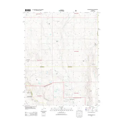
2013 Map of Washboard Rock
USGS Topo · Published 2013About this map
Big Cimarron Ranch and Watson Ranch highlight the working landscape of this Western Colorado high-country map, where the Cimarron River carves through a complex network of ditches and reservoirs. The intricate water management system is evident in labels like Veo Ditch, Butte Ditch, and the Cimarron Ditch, which redirect flow across the high mesas and basins. The southern portion of the sheet is dominated by the Uncompahgre National Forest, containing high-altitude landmarks such as Monument Pass and the namesake Washboard Rock. This 2013 survey provides a detailed look at the interface between the forest boundary and private ranch lands, specifically around Wells Basin and the Big Cimarron Campground. High-elevation water bodies, including Fish Cr Reservoir Number 1 and Hampton Lake, are connected by primitive paths like the Fish Creek Reservoir Trl 6224.0.
Find a feature on this map
51 named features on this map. Tap any name to fly to it.
Don’t see what you’re looking for? This feature index may not catch every label — zoom into the map to look around manually.
Map Details
Editions of this 2013 Washboard Rock Map
This is the sole edition of this map. No revisions or reprints were ever made.
Other maps of this area

1902 · Ouray
USGS Topo · 1:62,500

1903 · Lake City
USGS Topo · 1:62,500

1904 · Ouray
USGS Topo · 1:62,500

1905 · Lake City
USGS Topo · 1:62,500

1908 · Uncompahgre
USGS Topo · 1:125,000

1909 · Montrose
USGS Topo · 1:125,000

1911 · Uncompahgre
USGS Topo · 1:125,000

1911 · Montrose
USGS Topo · 1:125,000

1956 · Curecanti Needle
USGS Topo · 1:24,000

1956 · Cimarron
USGS Topo · 1:24,000