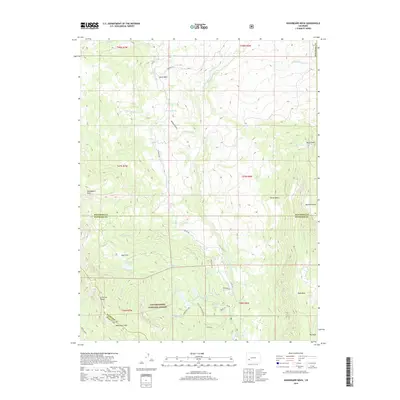
2019 Map of Washboard Rock
USGS Topo · Published 2019About this map
Uncompahgre National Forest dominates this high-altitude landscape, where the borders of Montrose, Gunnison, and Ouray counties converge. The terrain is defined by dramatic vertical relief, characterized by prominent features such as the Cimarron Ridge and the namesake Washboard Rock. This 2019 survey documents a complex network of water management and natural drainage, with the Cimarron River and several of its tributaries, including Burdeck Cr and Stewart Cr, carving through the mountain draws.
Find a feature on this map
47 named features on this map. Tap any name to fly to it.
Don’t see what you’re looking for? This feature index may not catch every label — zoom into the map to look around manually.
Map Details
Editions of this 2019 Washboard Rock Map
This is the sole edition of this map. No revisions or reprints were ever made.
Other maps of this area

1902 · Ouray
USGS Topo · 1:62,500

1903 · Lake City
USGS Topo · 1:62,500

1904 · Ouray
USGS Topo · 1:62,500

1905 · Lake City
USGS Topo · 1:62,500

1908 · Uncompahgre
USGS Topo · 1:125,000

1909 · Montrose
USGS Topo · 1:125,000

1911 · Uncompahgre
USGS Topo · 1:125,000

1911 · Montrose
USGS Topo · 1:125,000

1956 · Curecanti Needle
USGS Topo · 1:24,000

1956 · Cimarron
USGS Topo · 1:24,000