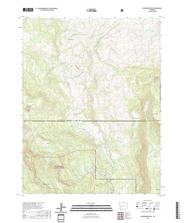
2022 Map of Washboard Rock
USGS Topo · Published 2022About this map
Uncompahgre National Forest encompasses much of this high-elevation landscape, where the Cimarron Ridge forms a prominent divide between the Cimarron River drainage and the surrounding draws. The map illustrates a complex network of water management features essential to the region's ranching and agricultural history, including the Cimarron Ditch, Veo Ditch, and Butte Ditch. These man-made channels divert water across varied terrain to reaches like Wells Basin and Moore Pasture.
Find a feature on this map
51 named features on this map. Tap any name to fly to it.
Don’t see what you’re looking for? This feature index may not catch every label — zoom into the map to look around manually.
Map Details
Editions of this 2022 Washboard Rock Map
This is the sole edition of this map. No revisions or reprints were ever made.
Other maps of this area

1902 · Ouray
USGS Topo · 1:62,500

1903 · Lake City
USGS Topo · 1:62,500

1904 · Ouray
USGS Topo · 1:62,500

1905 · Lake City
USGS Topo · 1:62,500

1908 · Uncompahgre
USGS Topo · 1:125,000

1909 · Montrose
USGS Topo · 1:125,000

1911 · Uncompahgre
USGS Topo · 1:125,000

1911 · Montrose
USGS Topo · 1:125,000

1956 · Curecanti Needle
USGS Topo · 1:24,000

1956 · Cimarron
USGS Topo · 1:24,000