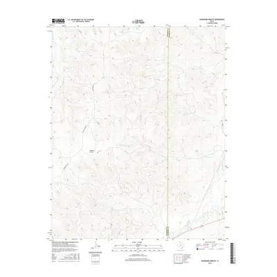
2016 Map of Washburn Arroyo
USGS Topo · Published 2016About this map
Washburn Arroyo and its complex system of drainages define this portion of the Texas Panhandle near the Roberts and Hemphill County line. The landscape is primarily shaped by the winding paths of S Simmons Cr and Red Deer Cr, which cut through the high plains terrain. A network of rural ranch roads, including Quarter Horse Rd, S Camp Rd, and Lister Rd, provide access through the open country, linking scattered points of activity in this agricultural and ranching region. The northeastern corner is marked by Mendota, positioned near the flowing Simmons Cr. The distribution of Home Ranch Cr and other waterways highlights the critical role of riparian corridors in sustaining the local environment and its grazing operations. These 2016 survey details show how modern ranching infrastructure continues to follow the natural contours of the arroyos and creeks established long ago.
Find a feature on this map
11 named features on this map. Tap any name to fly to it.
Don’t see what you’re looking for? This feature index may not catch every label — zoom into the map to look around manually.
Map Details
Editions of this 2016 Washburn Arroyo Map
This is the sole edition of this map. No revisions or reprints were ever made.
Other maps of this area

1954 · Amarillo
USGS Topo · 1:250,000

1958 · Amarillo
USGS Topo · 1:250,000

1967 · Mendota
USGS Topo · 1:24,000

1967 · Young Ranch
USGS Topo · 1:24,000

1967 · Lora
USGS Topo · 1:24,000

1972 · Washburn Arroyo
USGS Topo · 1:24,000

1972 · Horse Creek North
USGS Topo · 1:24,000

1972 · Canadian West
USGS Topo · 1:24,000

1972 · East Dry Creek
USGS Topo · 1:24,000

1972 · Miami
USGS Topo · 1:24,000