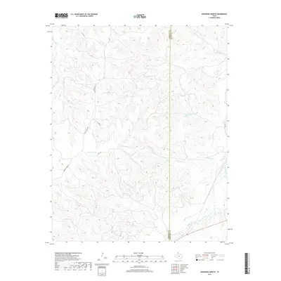
2019 Map of Washburn Arroyo
USGS Topo · Published 2019About this map
Washburn Arroyo carves a complex network of drainages across the Texas Panhandle, defining the eastern portion of Roberts County along the boundary with Hemphill County. This terrain is characterized by a dense system of intermittent streams and tributary branches, including the waters of Home Ranch Cr and S Simmons Cr. The landscape is etched with the deep incisions of the Canadian River watershed, where the land falls away toward Red Deer Cr in the southeast. Ranching infrastructure and local transit are evident through the network of specialized routes such as Quarter Horse Rd, Getty Rd, and S Camp Rd, which navigate the high divides and arroyo floors. The survey captures the sparse, utilitarian layout of the high plains, where place names like Mendota mark specific points of interest in an otherwise expansive and deeply dissected prairie.
Find a feature on this map
11 named features on this map. Tap any name to fly to it.
Don’t see what you’re looking for? This feature index may not catch every label — zoom into the map to look around manually.
Map Details
Editions of this 2019 Washburn Arroyo Map
This is the sole edition of this map. No revisions or reprints were ever made.
Other maps of this area

1954 · Amarillo
USGS Topo · 1:250,000

1958 · Amarillo
USGS Topo · 1:250,000

1967 · Mendota
USGS Topo · 1:24,000

1967 · Young Ranch
USGS Topo · 1:24,000

1967 · Lora
USGS Topo · 1:24,000

1972 · Washburn Arroyo
USGS Topo · 1:24,000

1972 · Horse Creek North
USGS Topo · 1:24,000

1972 · Canadian West
USGS Topo · 1:24,000

1972 · East Dry Creek
USGS Topo · 1:24,000

1972 · Miami
USGS Topo · 1:24,000