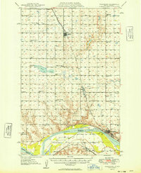
1949 Map of Washburn
USGS Topo · Published 1949About this map
The Missouri River forms a wide curve through the southern portion of this landscape, serving as the border between McLean and Oliver counties. Along the northern banks, the city of Washburn and the village of Hensler stand as key riverfront settlements, connected by the Northern Pacific railroad. To the north, the terrain transitions into a dense grid of rural school districts and family farms, where small community hubs like Underwood and Falkirk sit along the Minneapolis St Paul and Sault Ste Marie line.
Find a feature on this map
36 named features on this map. Tap any name to fly to it.
Don’t see what you’re looking for? This feature index may not catch every label — zoom into the map to look around manually.
Map Details
Editions of this 1949 Washburn Map
2 editions found
Other maps of this area

1922 · Garrison
USGS Topo · 1:62,500

1929 · Coleharbor
USGS Topo · 1:62,500

1947 · Turtle Lake
USGS Topo · 1:62,500

1948 · Stanton
USGS Topo · 1:62,500

1949 · Stanton
USGS Topo · 1:62,500

1949 · Turtle Creek
USGS Topo · 1:62,500

1949 · Washburn
USGS Topo · 1:62,500

1950 · Wilton
USGS Topo · 1:62,500

1954 · McClusky
USGS Topo · 1:250,000

1958 · McClusky
USGS Topo · 1:250,000