
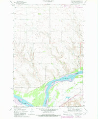
1967 Map of Washburn SW
USGS Topo · Published 1968About this map
The Missouri River forms a wide, braided channel along the border of McLean and Oliver Counties, anchoring this mid-1960s topographic study. The landscape is defined by the sharp contrast between the river's riparian bottomlands and the upland plateaus, where industrial activity and early community centers are documented. North of the river, the Black Diamond Mine and a local Gravel Pit indicate the extractive economy of the region, while the Coal Lake Coulee cuts a deep drainage path toward the southern river valley.
Find a feature on this map
10 named features on this map. Tap any name to fly to it.
Don’t see what you’re looking for? This feature index may not catch every label — zoom into the map to look around manually.
Map Details
Editions of this 1967 Washburn SW Map
2 editions found
Other maps of this area

1948 · Stanton
USGS Topo · 1:62,500

1949 · Stanton
USGS Topo · 1:62,500

1949 · Washburn
USGS Topo · 1:62,500

1954 · McClusky
USGS Topo · 1:250,000

1958 · McClusky
USGS Topo · 1:250,000

1961 · Washburn
USGS Topo · 1:24,000

1961 · Washburn NE
USGS Topo · 1:24,000

1961 · Underwood
USGS Topo · 1:24,000

1967 · Stanton SE
USGS Topo · 1:24,000

1968 · Hannover NE
USGS Topo · 1:24,000