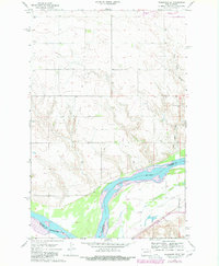
1967 Map of Washburn SW
USGS Topo · Published 1980About this map
The Missouri River cuts a wide path through this North Dakota landscape, marking the natural boundary between McLean and Oliver Counties. The terrain is characterized by the complex drainage systems of the Coal Lake Coulee and several unnamed draws that feed into the river valley. Evidence of the region’s industrial and agricultural development is found in the Black Diamond Mine and a local powerplant near the northern edge of the sheet. Transportation networks are well-defined by the Soo Line and Burlington Northern railroads, which parallel the river's course. Local history is anchored by the Birka Ch and its accompanying Birka Ch Cem, alongside the Conklin Cem, providing valuable landmarks for genealogical research in this rural riverine area.
Find a feature on this map
14 named features on this map. Tap any name to fly to it.
Don’t see what you’re looking for? This feature index may not catch every label — zoom into the map to look around manually.
Map Details
Editions of this 1967 Washburn SW Map
2 editions found
Other maps of this area

1948 · Stanton
USGS Topo · 1:62,500

1949 · Stanton
USGS Topo · 1:62,500

1949 · Washburn
USGS Topo · 1:62,500

1954 · McClusky
USGS Topo · 1:250,000

1958 · McClusky
USGS Topo · 1:250,000

1961 · Washburn
USGS Topo · 1:24,000

1961 · Washburn NE
USGS Topo · 1:24,000

1961 · Underwood
USGS Topo · 1:24,000

1967 · Washburn SW
USGS Topo · 1:24,000

1967 · Stanton SE
USGS Topo · 1:24,000