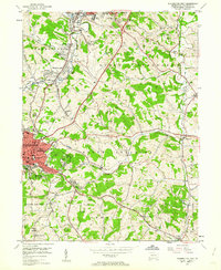
1953 Map of Washington East
USGS Topo · Published 1962About this map
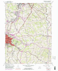
Industrial activity and academic life converge in this mid-century survey of the Pennsylvania hills. Washington and East Washington serve as the regional anchors, dominated by the campus of Washington and Jefferson College and several historic burial grounds, including the Beth Israel Cemetery and Immaculate Conception Cem. The landscape is deeply defined by extraction, with numerous sites like the Lindley Mine, the Mc Lane Mine, and expansive Strip Mine operations scattered throughout the Chartiers and North Strabane townships. This 1953 field check captures a transitional moment where traditional coal mining and rail transport via the Pennsylvania RR and Baltimore And Ohio RR exist alongside newer cultural landmarks like the Drive-in Theater near Manifold. The presence of specialized facilities such as the Hillsview Sanatorium and multiple rural schools like Brownlee Sch provides a window into the social infrastructure of the era.
Find a feature on this map
65 named features on this map. Tap any name to fly to it.
Don’t see what you’re looking for? This feature index may not catch every label — zoom into the map to look around manually.
Map Details
Editions of this 1953 Washington East Map
5 editions found
Other maps of this area

1901 · Amity
USGS Topo · 1:62,500

1904 · Amity
USGS Topo · 1:62,500

1904 · Carnegie
USGS Topo · 1:62,500

1904 · Burgettstown
USGS Topo · 1:62,500

1906 · Burgettstown
USGS Topo · 1:62,500

1906 · Carnegie
USGS Topo · 1:62,500

1907 · Claysville
USGS Topo · 1:62,500

1908 · Carnegie
USGS Topo · 1:62,500

1951 · Canton
USGS Topo · 1:250,000

1953 · Canton
USGS Topo · 1:250,000
Featured Places
- Washington, PA
- South Strabane Township, PA
- Mount Pleasant, South Strabane Township
- McGovern, Chartiers Township
- East Washington, PA