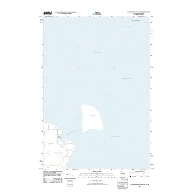
2011 Map of Washington Island NE
USGS Topo · Published 2011About this map
Saint Martin Island and Rock Island stand as key landmarks in this maritime survey of the northern reaches of Lake Michigan. The map details the critical water routes of the Saint Martin Island Passage and Rock Island Passage, which have long served as primary gateways between the lake and Green Bay. On Washington Island, a network of local roads such as Jackson Harbor Rd and Indian Point Rd connects the interior to the shoreline, where the Washington Island-Rock Island (State Park Ferry) provides the only link to the neighboring island park. Further north, the secluded Saint Martin Island Cemetery remains a quiet marker of the small community that once lived on these isolated outposts. The inclusion of smaller features like Fish Island and protected coves like Southwest Bay illustrates the intricate shoreline of the Door County archipelago.
Find a feature on this map
24 named features on this map. Tap any name to fly to it.
Don’t see what you’re looking for? This feature index may not catch every label — zoom into the map to look around manually.
Map Details
Editions of this 2011 Washington Island NE Map
This is the sole edition of this map. No revisions or reprints were ever made.
Other maps of this area

1932 · Burnt Bluff SW
USGS Topo · 1:31,680

1954 · Escanaba
USGS Topo · 1:250,000

1957 · Escanaba
USGS Topo · 1:250,000

1958 · Escanaba
USGS Topo · 1:250,000

1958 · Peninsula Point
USGS Topo · 1:62,500

1958 · Fairport
USGS Topo · 1:62,500

1960 · Washington Island
USGS Topo · 1:62,500

1982 · Washington Island SE
USGS Topo · 1:24,000

1982 · Washington Island NW
USGS Topo · 1:24,000

1982 · Washington Island NE
USGS Topo · 1:24,000