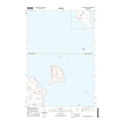
2016 Map of Washington Island NE
USGS Topo · Published 2016About this map
Saint Martin Island and its isolated Saint Martin Island Cem anchor the northern reaches of this maritime survey, illustrating the threshold between Michigan's Delta County and Wisconsin's Door County. This area of Lake Michigan is defined by treacherous navigation through the Saint Martin Island Passage and Rock Island Passage, corridors that have historically shaped the trade routes of the Great Lakes. To the south, the tip of Washington Island reveals a concentration of local history around Jackson Harbor, where residential roads like Pedants Ln and Old Indian Point Rd intersect the coastal landscape. The presence of Little Marsh and Fisherman Shoal highlights the varied aquatic environment, while the interior of Rock Island shows significant topographic relief, providing a clear record of the island's natural structure before more modern coastal developments.
Find a feature on this map
32 named features on this map. Tap any name to fly to it.
Don’t see what you’re looking for? This feature index may not catch every label — zoom into the map to look around manually.
Map Details
Editions of this 2016 Washington Island NE Map
This is the sole edition of this map. No revisions or reprints were ever made.
Other maps of this area

1932 · Burnt Bluff SW
USGS Topo · 1:31,680

1954 · Escanaba
USGS Topo · 1:250,000

1957 · Escanaba
USGS Topo · 1:250,000

1958 · Escanaba
USGS Topo · 1:250,000

1958 · Peninsula Point
USGS Topo · 1:62,500

1958 · Fairport
USGS Topo · 1:62,500

1960 · Washington Island
USGS Topo · 1:62,500

1982 · Washington Island SE
USGS Topo · 1:24,000

1982 · Washington Island NW
USGS Topo · 1:24,000

1982 · Washington Island NE
USGS Topo · 1:24,000