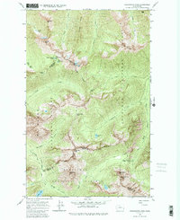
1963 Map of Washington Pass
USGS Topo · Published 1986About this map
Washington Pass serves as a central topographical anchor where the boundaries of Okanogan, Chelan, and Skagit counties meet. This high-altitude wilderness is defined by its dramatic peaks and technical climbing features, such as the Liberty Bell Mtn and the jagged Early Winters Spires. The landscape is carved by numerous drainages including Early Winters Creek and Swamp Creek, which flow from high glacial basins like those containing Nugget Lakes and Blue Lake.
Find a feature on this map
42 named features on this map. Tap any name to fly to it.
Don’t see what you’re looking for? This feature index may not catch every label — zoom into the map to look around manually.
Map Details
Editions of this 1963 Washington Pass Map
3 editions found
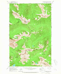
Other maps of this area

1902 · Stehekin
USGS Topo · 1:125,000

1904 · Stehekin
USGS Topo · 1:125,000

1920 · Slate Pass
USGS Topo · 1:125,000

1955 · Concrete
USGS Topo · 1:250,000

1958 · Concrete
USGS Topo · 1:250,000

1962 · Concrete
USGS Topo · 1:250,000

1963 · Washington Pass
USGS Topo · 1:24,000

1963 · Mc Gregor Mtn
USGS Topo · 1:24,000

1963 · Azurite Peak
USGS Topo · 1:24,000

1963 · Slate Peak
USGS Topo · 1:24,000