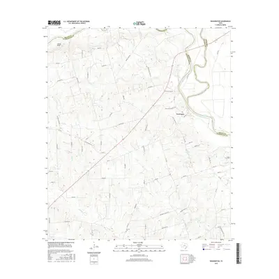
2016 Map of Washington
USGS Topo · Published 2016About this map
The historic settlement of Washington sits at a strategic junction near the confluence of the Brazos River and the Navasota River. This landscape in Washington County is defined by the winding river boundaries and prominent terrain such as the Hidalgo Bluffs to the northwest. The map detail reflects a deeply rooted rural community, where numerous creek systems like Coles Cr, Doe Run, and Rocky Cr carve through the countryside. Genealogists and local historians can locate established burial grounds, including Tennyson Cem and Evans Prairie Cem, which anchor the area's family histories. The network of farm-to-market roads and named lanes, such as William Penn Rd and Dill Hill Ln, connects the disparate homesteads and farming tracts that characterize this portion of the Texas Brazos Valley.
Find a feature on this map
71 named features on this map. Tap any name to fly to it.
Don’t see what you’re looking for? This feature index may not catch every label — zoom into the map to look around manually.
Map Details
Editions of this 2016 Washington Map
This is the sole edition of this map. No revisions or reprints were ever made.
Other maps of this area

1913 · Millican
USGS Topo · 1:31,680

1914 · Gay Hill
USGS Topo · 1:62,500

1914 · Navasota
USGS Topo · 1:62,500

1930 · Brenham
USGS Topo · 1:62,500

1954 · Austin
USGS Topo · 1:250,000

1956 · Hempstead
USGS Topo · 1:62,500

1956 · Brenham
USGS Topo · 1:62,500

1958 · Washington
USGS Topo · 1:24,000

1958 · Navasota
USGS Topo · 1:24,000

1958 · Courtney
USGS Topo · 1:24,000