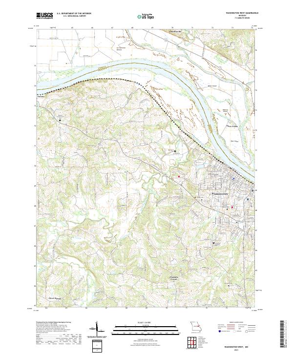
2021 Map of Washington West
USGS Topo · Published 2021About this map
Washington and the surrounding river bottoms of Franklin and Warren Counties are defined by the wide sweep of the Missouri River. On the north bank, the community of Marthasville sits at the edge of the La Charrette Bottom, while the south bank features the denser grid of Washington's western neighborhoods. The landscape is dotted with small cemeteries that speak to the area's long-standing family foundations, including Sappington Cem and Wildey Cem.
Find a feature on this map
176 named features on this map. Tap any name to fly to it.
Don’t see what you’re looking for? This feature index may not catch every label — zoom into the map to look around manually.
Map Details
Editions of this 2021 Washington West Map
This is the sole edition of this map. No revisions or reprints were ever made.
Other maps of this area

1890 · Hermann
USGS Topo · 1:125,000

1901 · De Soto
USGS Topo · 1:125,000

1903 · O'Fallon
USGS Topo · 1:125,000

1903 · Sullivan
USGS Topo · 1:125,000

1946 · Union
USGS Topo · 1:62,500

1947 · St. Clair
USGS Topo · 1:62,500

1948 · Union
USGS Topo · 1:62,500

1948 · Washington
USGS Topo · 1:62,500

1948 · Augusta
USGS Topo · 1:62,500

1949 · Saint Louis
USGS Topo · 1:250,000