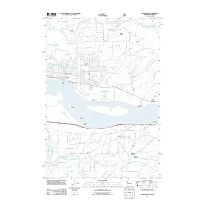
2011 Map of Washougal
USGS Topo · Published 2011About this map
The Columbia River serves as the dominant geographical divide on this 2011 survey, separating the growing residential corridors of Washington from the canyon-defined landscapes of Oregon. In the north, the Washougal townsite is flanked by Woodburn Hill and Mount Norway, with clear evidence of local heritage at the Sunnyside Cemetery and Washougal Memorial Cemetery. The river itself is dotted with prominent landforms like Reed Island and Gary Island, leading south toward the rugged Oregon shoreline. South of the river, the landscape transitions into the steep terrain of Chamberlain Hill and Knieriem Canyon. This area is characterized by the small settlements of Corbett and Springdale, connected by the winding Crown Point Hwy. Genealogists will find interest in the documented locations of the Mountain View Cemetery and Pounder Cemetery, alongside the transition from riverfront flats near Steigerwald Lake to the higher elevations of Mount Pleasant.
Find a feature on this map
51 named features on this map. Tap any name to fly to it.
Don’t see what you’re looking for? This feature index may not catch every label — zoom into the map to look around manually.
Map Details
Editions of this 2011 Washougal Map
This is the sole edition of this map. No revisions or reprints were ever made.
Other maps of this area

1911 · Boring
USGS Topo · 1:48,000

1914 · Boring
USGS Topo · 1:62,500

1916 · Estacada
USGS Topo · 1:125,000

1918 · Troutdale
USGS Topo · 1:62,500

1934 · Troutdale
USGS Topo · 1:48,000

1940 · Boring
USGS Topo · 1:62,500

1941 · Camas
USGS Topo · 1:62,500

1942 · Camas
USGS Topo · 1:62,500

1948 · Vancouver
USGS Topo · 1:250,000

1950 · Vancouver
USGS Topo · 1:250,000