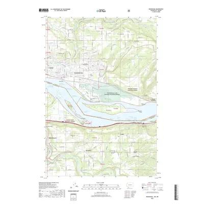
2020 Map of Washougal
USGS Topo · Published 2020About this map
The Columbia River forms the central axis of this landscape, separating the Washington and Oregon borders while defining the development of Camas and Washougal. This riverine corridor is marked by a complex network of channels and islands, including Gary Island and Reed Island, which sit within the Columbia Gorge. On the Washington side, the Steigerwald Lake National Wildlife Refuge preserves critical wetlands along Gibbons Creek, while the hills rise sharply toward Mt Norway and the Gifford Pinchot National Forest. South across the water, the Oregon shore near Troutdale features the mouth of the Sandy River and the high bluffs of Broughton Bluff. Genealogical and local history points are well represented by numerous burial sites, such as Sunnyside Cem and Washougal Memorial Cem, alongside small rural settlements like Corbett and Springdale.
Find a feature on this map
109 named features on this map. Tap any name to fly to it.
Don’t see what you’re looking for? This feature index may not catch every label — zoom into the map to look around manually.
Map Details
Editions of this 2020 Washougal Map
This is the sole edition of this map. No revisions or reprints were ever made.
Other maps of this area

1911 · Boring
USGS Topo · 1:48,000

1914 · Boring
USGS Topo · 1:62,500

1916 · Estacada
USGS Topo · 1:125,000

1918 · Troutdale
USGS Topo · 1:62,500

1934 · Troutdale
USGS Topo · 1:48,000

1940 · Boring
USGS Topo · 1:62,500

1941 · Camas
USGS Topo · 1:62,500

1942 · Camas
USGS Topo · 1:62,500

1948 · Vancouver
USGS Topo · 1:250,000

1950 · Vancouver
USGS Topo · 1:250,000