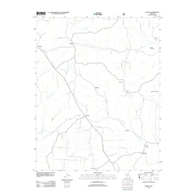
2012 Map of Wasola
USGS Topo · Published 2012About this map
Wasola and Almartha anchor this corner of the Ozarks, where the terrain is defined by deep hollows and high ridges that direct the flow of numerous spring-fed tributaries. The landscape is marked by the distinctive Devils Backbone and Hilo Ridge, which separate the headwaters of Spring Creek and Turkey Creek. This area of Missouri is characterized by a high density of small, family-associated burial grounds, including the Loftin Cemetery, Hilo Cemetery, and Herndon Cemetery, reflecting the long-standing community ties in settlements like Silverton and Girdner.
Find a feature on this map
58 named features on this map. Tap any name to fly to it.
Don’t see what you’re looking for? This feature index may not catch every label — zoom into the map to look around manually.
Map Details
Editions of this 2012 Wasola Map
This is the sole edition of this map. No revisions or reprints were ever made.
Other maps of this area

1934 · Gainesville
USGS Topo · 1:48,000

1936 · Thornfield
USGS Topo · 1:48,000

1936 · Ava
USGS Topo · 1:48,000

1937 · Buckhart
USGS Topo · 1:48,000

1940 · Gainesville
USGS Topo · 1:62,500

1942 · Ava
USGS Topo · 1:62,500

1943 · Thornfield
USGS Topo · 1:62,500

1943 · Buckhart
USGS Topo · 1:62,500

1945 · Ava
USGS Topo · 1:62,500

1945 · Harrison
USGS Topo · 1:250,000