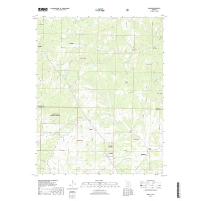
2017 Map of Wasola
USGS Topo · Published 2017About this map
Wasola and Almartha anchor the southern reaches of this Ozark landscape, where the boundary between Douglas and Ozark counties divides the terrain. This 2017 survey details the complex network of hollows and ridges that define the area, most notably the prominent Coon Knob Hill and the distinctive Devils Backbone near Rippee Cr. The transition from rural homesteads to protected timber is evident as the Mark Twain National Forest encompasses much of the southwestern quadrant, punctuated by topographic features like Mount Lebanon Hollow. For genealogists and local historians, the map serves as a contemporary guide to several family and community landmarks, including Loftin Cem, Hilo Cem, and Herndon Cem. The hydrography of the region is equally detailed, tracing the winding paths of Spring Cr and the curious Spring Spring in the central hills.
Find a feature on this map
67 named features on this map. Tap any name to fly to it.
Don’t see what you’re looking for? This feature index may not catch every label — zoom into the map to look around manually.
Map Details
Editions of this 2017 Wasola Map
This is the sole edition of this map. No revisions or reprints were ever made.
Other maps of this area

1934 · Gainesville
USGS Topo · 1:48,000

1936 · Thornfield
USGS Topo · 1:48,000

1936 · Ava
USGS Topo · 1:48,000

1937 · Buckhart
USGS Topo · 1:48,000

1940 · Gainesville
USGS Topo · 1:62,500

1942 · Ava
USGS Topo · 1:62,500

1943 · Thornfield
USGS Topo · 1:62,500

1943 · Buckhart
USGS Topo · 1:62,500

1945 · Ava
USGS Topo · 1:62,500

1945 · Harrison
USGS Topo · 1:250,000