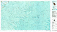
1980 Map of Wassaw Sound
USGS Topo · Published 1983About this map
Fort Pulaski National Monument stands at the mouth of the Savannah River, marking a landscape of barrier islands and salt marshes that defines the Chatham County coastline. This 1980 survey, produced through the cooperation of the U.S. Geological Survey and the National Ocean Survey, transitions from the developed community of Wilmington Island and the residential streets of Wilmington Park to the untamed reaches of the Wassaw National Wildlife Refuge. The map provides a detailed topographic-bathymetric view of the sounds and inlets, illustrating the complex relationship between land and water at Wassaw Sound.
Find a feature on this map
17 named features on this map. Tap any name to fly to it.
Don’t see what you’re looking for? This feature index may not catch every label — zoom into the map to look around manually.
Map Details
Editions of this 1980 Wassaw Sound Map
2 editions found
Other maps of this area

1920 · Wassaw Sound
USGS Topo · 1:62,500

1920 · Cabretta Island
USGS Topo · 1:62,500

1920 · Hilton Head
USGS Topo · 1:62,500

1920 · Bluffton
USGS Topo · 1:62,500

1928 · St Catherines Island
USGS Topo · 1:62,500

1942 · Savannah
USGS Topo · 1:62,500

1943 · St Catherines Island
USGS Topo · 1:62,500

1944 · Cabretta Island
USGS Topo · 1:62,500

1944 · Ossabaw Island
USGS Topo · 1:62,500

1945 · St. Catherine's Island
USGS Topo · 1:62,500