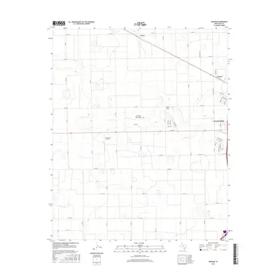
2016 Map of Wasson
USGS Topo · Published 2016About this map
The western residential outskirts of Plainview meet the agricultural expanse of the Texas Panhandle in this contemporary topographic study. The landscape is characterized by its organized grid of county roads, such as Co Rd 80 and Co Rd 100, which delineate vast sections of farmland. Cutting through this geometric precision are the natural, winding paths of ephemeral watercourses like Running Water Draw and Slaton Draw. These features represent the subtle relief of the Llano Estacado, where small depressions and drainage patterns provide the only deviation from the flat terrain.
Find a feature on this map
43 named features on this map. Tap any name to fly to it.
Don’t see what you’re looking for? This feature index may not catch every label — zoom into the map to look around manually.
Map Details
Editions of this 2016 Wasson Map
This is the sole edition of this map. No revisions or reprints were ever made.
Other maps of this area

1954 · Plainview
USGS Topo · 1:250,000

1958 · Plainview
USGS Topo · 1:250,000

1965 · Kress West
USGS Topo · 1:24,000

1965 · Edmonson
USGS Topo · 1:24,000

1965 · Wasson
USGS Topo · 1:24,000

1965 · Plainview
USGS Topo · 1:24,000

1968 · Halfway
USGS Topo · 1:24,000

1968 · Happy Union
USGS Topo · 1:24,000
1968 · Hale Center SW
USGS Topo · 1:24,000
1968 · Hale Center
USGS Topo · 1:24,000