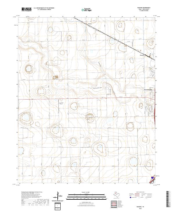
2022 Map of Wasson
USGS Topo · Published 2022About this map
The edge of Plainview anchors this portion of the Texas South Plains, where urban expansion meets a grid of rural agricultural roads. This 2022 survey documents the residential fringe of the city along Mesa Dr and Yucca Ter, contrasting with the expansive open sections to the west. Two ephemeral waterways, Running Water Draw and Staton Draw, carve subtle paths through the landscape, influencing the placement of local infrastructure like the Quarterway Airport.
Find a feature on this map
42 named features on this map. Tap any name to fly to it.
Don’t see what you’re looking for? This feature index may not catch every label — zoom into the map to look around manually.
Map Details
Editions of this 2022 Wasson Map
This is the sole edition of this map. No revisions or reprints were ever made.
Other maps of this area

1954 · Plainview
USGS Topo · 1:250,000

1958 · Plainview
USGS Topo · 1:250,000

1965 · Kress West
USGS Topo · 1:24,000

1965 · Edmonson
USGS Topo · 1:24,000

1965 · Wasson
USGS Topo · 1:24,000

1965 · Plainview
USGS Topo · 1:24,000

1968 · Halfway
USGS Topo · 1:24,000

1968 · Happy Union
USGS Topo · 1:24,000
1968 · Hale Center SW
USGS Topo · 1:24,000
1968 · Hale Center
USGS Topo · 1:24,000