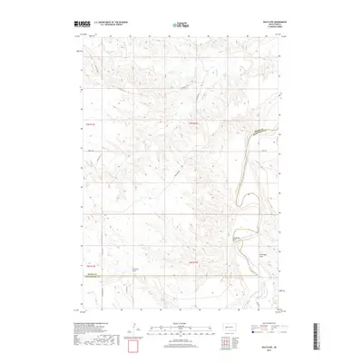
2017 Map of Wasta NW
USGS Topo · Published 2017About this map
The Cheyenne River winds through the eastern edge of this landscape, carving a wide valley along the boundary between Meade Co and Pennington Co. This 2017 survey reveals a terrain defined by significant drainage systems, including the aptly named Telegraph Draw, Seventysix Draw, and Fivemile Draw. These features suggest a topography heavily influenced by seasonal water movement across the plains.
Find a feature on this map
18 named features on this map. Tap any name to fly to it.
Don’t see what you’re looking for? This feature index may not catch every label — zoom into the map to look around manually.
Map Details
Editions of this 2017 Wasta NW Map
This is the sole edition of this map. No revisions or reprints were ever made.
Other maps of this area

1953 · Rapid City
USGS Topo · 1:250,000

1954 · Dalzell SE
USGS Topo · 1:24,000

1954 · Wasta NE
USGS Topo · 1:24,000

1954 · Wasta SE
USGS Topo · 1:24,000

1954 · Dalzell
USGS Topo · 1:24,000

1954 · Wasta
USGS Topo · 1:24,000

1954 · Owanka
USGS Topo · 1:24,000

1954 · Wasta NW
USGS Topo · 1:24,000

1954 · Elm Springs
USGS Topo · 1:24,000

1957 · Rapid City
USGS Topo · 1:250,000