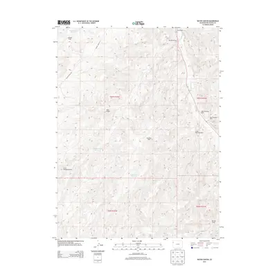
2013 Map of Water Canyon
USGS Topo · Published 2013About this map
Douglas Creek flows through this arid sector of Rio Blanco County, shaping a complex network of erosional features and drainage systems. The landscape is defined by its deep incisions and namesake features like Water Canyon and Johnson Draw. To support livestock and land management in this high-desert environment, several man-made catchments have been established, including Johnson Draw Reservoir, Big Horse Draw Reservoir, and W Fourmile Reservoir. Access is primarily facilitated by the Rangely Dragon Rd and Highway 139, which thread through the varied topography. The map illustrates a classic Western drainage pattern where numerous named draws, such as Little Fourmile Draw and Big Bull Draw, converge toward the central creek bed, reflecting the critical role of water management and geography in this part of Colorado.
Find a feature on this map
20 named features on this map. Tap any name to fly to it.
Don’t see what you’re looking for? This feature index may not catch every label — zoom into the map to look around manually.
Map Details
Editions of this 2013 Water Canyon Map
This is the sole edition of this map. No revisions or reprints were ever made.
Other maps of this area

1907 · Rangely
USGS Topo · 1:125,000

1910 · Rangely
USGS Topo · 1:125,000

1954 · Vernal
USGS Topo · 1:250,000

1956 · Grand Junction
USGS Topo · 1:250,000

1958 · Vernal
USGS Topo · 1:250,000

1959 · Grand Junction
USGS Topo · 1:250,000

1960 · Vernal
USGS Topo · 1:250,000

1960 · Grand Junction
USGS Topo · 1:250,000

1962 · Grand Junction
USGS Topo · 1:250,000
1962 · Rangely
USGS Topo · 1:24,000