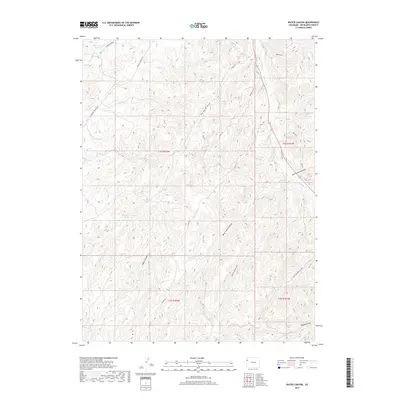
2019 Map of Water Canyon
USGS Topo · Published 2019About this map
Water Canyon and the surrounding high desert of Rio Blanco County are defined by a complex network of ephemeral drainages and essential water management features. In this arid landscape, the presence of Big Horse Draw Reservoir, West Fourmile Reservoir, and Johnson Draw Reservoir indicates the critical role of water storage for ranching or land management. The terrain is deeply incised by named draws, including Big Horse Draw, East Fourmile Draw, and West Fourmile Draw, which feed into the larger Douglas Creek system. This 2019 survey shows the region's limited transportation network, primarily consisting of graded routes like Rangely Dragon Rd and Co RD 105, which navigate the plateaus and canyon floors to connect this secluded corner of Western Colorado.
Find a feature on this map
23 named features on this map. Tap any name to fly to it.
Don’t see what you’re looking for? This feature index may not catch every label — zoom into the map to look around manually.
Map Details
Editions of this 2019 Water Canyon Map
This is the sole edition of this map. No revisions or reprints were ever made.
Other maps of this area

1907 · Rangely
USGS Topo · 1:125,000

1910 · Rangely
USGS Topo · 1:125,000

1954 · Vernal
USGS Topo · 1:250,000

1956 · Grand Junction
USGS Topo · 1:250,000

1958 · Vernal
USGS Topo · 1:250,000

1959 · Grand Junction
USGS Topo · 1:250,000

1960 · Vernal
USGS Topo · 1:250,000

1960 · Grand Junction
USGS Topo · 1:250,000

1962 · Grand Junction
USGS Topo · 1:250,000
1962 · Rangely
USGS Topo · 1:24,000