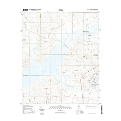
2015 Map of Water Valley West
USGS Topo · Published 2015About this map
Enid Lake dominates the central landscape of this North Mississippi survey, where the borders of Panola, Lafayette, and Yalobusha counties converge. The eastern edge of the map features the city of Water Valley, showing its residential street grid including W Lee St and Airway Acres Dr. The topography is defined by the winding paths of the Yocona River and Otoucalofa Creek, which drain into the lake's broad basin. Local history and genealogy researchers will find numerous rural landmarks preserved, from the Dallas Jones Crossing to several country cemeteries such as Pine Spring Cem and Big Springs Cem. The transportation network includes rural routes like Old Fly Rd and Prophet Bridge Crossing, alongside the Water Valley Municipal Airport, reflecting the area's mix of traditional river-bottom geography and modern infrastructure.
Find a feature on this map
110 named features on this map. Tap any name to fly to it.
Don’t see what you’re looking for? This feature index may not catch every label — zoom into the map to look around manually.
Map Details
Editions of this 2015 Water Valley West Map
This is the sole edition of this map. No revisions or reprints were ever made.
Other maps of this area

1940 · Oxford
USGS Topo · 1:62,500

1943 · Oxford
USGS Topo · 1:62,500

1952 · Sardis
USGS Topo · 1:62,500

1953 · Sardis
USGS Topo · 1:62,500

1954 · Oakland
USGS Topo · 1:62,500

1954 · Water Valley
USGS Topo · 1:62,500

1954 · Water Valley West
USGS Topo · 1:24,000

1955 · Water Valley
USGS Topo · 1:62,500

1956 · Tupelo
USGS Topo · 1:250,000

1958 · Tupelo
USGS Topo · 1:250,000