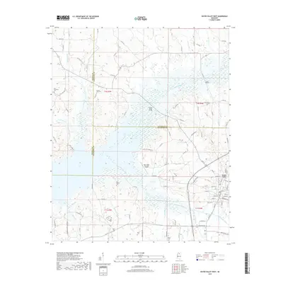
2018 Map of Water Valley West
USGS Topo · Published 2018About this map
Water Valley anchors the southeastern corner of this landscape, where the town street grid meets the winding course of Otoucalofa Creek. The geography is defined by the significant footprint of Enid Lake, which dominates the western and central portions of the sheet. This large reservoir, fed by Otoucalofa Creek, Bynum Creek, and Flowers Creek, has fundamentally altered the local drainage patterns and land use, creating a massive water body where traditional valley farming once occurred.
Find a feature on this map
102 named features on this map. Tap any name to fly to it.
Don’t see what you’re looking for? This feature index may not catch every label — zoom into the map to look around manually.
Map Details
Editions of this 2018 Water Valley West Map
This is the sole edition of this map. No revisions or reprints were ever made.
Other maps of this area

1940 · Oxford
USGS Topo · 1:62,500

1943 · Oxford
USGS Topo · 1:62,500

1952 · Sardis
USGS Topo · 1:62,500

1953 · Sardis
USGS Topo · 1:62,500

1954 · Oakland
USGS Topo · 1:62,500

1954 · Water Valley
USGS Topo · 1:62,500

1954 · Water Valley West
USGS Topo · 1:24,000

1955 · Water Valley
USGS Topo · 1:62,500

1956 · Tupelo
USGS Topo · 1:250,000

1958 · Tupelo
USGS Topo · 1:250,000