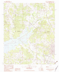
1983 Map of Water Valley West
USGS Topo · Published 1983About this map
The Yocona River valley and the eastern reaches of Enid Lake anchor this 1980s landscape at the intersection of Panola, Lafayette, and Yalobusha counties. The town of Water Valley occupies the southeastern corner, serving as a hub where the Otoucalofa Creek drainage meets local transit lines and the Water Valley Municipal Airport. The map reveals a rural social geography defined by numerous small congregations and burial grounds, such as New Providence Ch and Kind Providence Ch near the northern boundary, and Sylva Rena Cem to the south. The transition from the rugged drainage of Bynum Creek to the shoreline of the reservoir highlights the mid-20th-century transformation of this region by the U.S. Corps of Engineers. Notable local landmarks including the Courthouse and Hospital in the city center provide precise anchor points for local historians.
Find a feature on this map
35 named features on this map. Tap any name to fly to it.
Don’t see what you’re looking for? This feature index may not catch every label — zoom into the map to look around manually.
Map Details
Editions of this 1983 Water Valley West Map
This is the sole edition of this map. No revisions or reprints were ever made.
Other maps of this area

1940 · Oxford
USGS Topo · 1:62,500

1943 · Oxford
USGS Topo · 1:62,500

1952 · Sardis
USGS Topo · 1:62,500

1953 · Sardis
USGS Topo · 1:62,500

1954 · Oakland
USGS Topo · 1:62,500

1954 · Water Valley
USGS Topo · 1:62,500

1954 · Water Valley West
USGS Topo · 1:24,000

1955 · Water Valley
USGS Topo · 1:62,500

1956 · Tupelo
USGS Topo · 1:250,000

1958 · Tupelo
USGS Topo · 1:250,000