Loading...
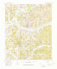
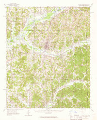
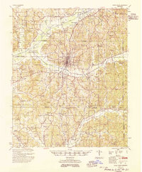
Loading map...1954 Map of Water Valley
USGS Topo · Published 1980About this map
The Illinois Central Railroad serves as the industrial backbone of this North Mississippi landscape, running directly through the heart of Water Valley. To the west, the recently completed Enid Reservoir on the Yocona River has reshaped the local geography, creating Enid Lake and a series of conservation pools. This survey documents the transition of a region defined by its creek valleys and rural social centers just after the mid-century.
Find a feature on this map
108 named features on this map. Tap any name to fly to it.
Don’t see what you’re looking for? This feature index may not catch every label — zoom into the map to look around manually.
Map Details
Date Portrayed1954
Date Published1980
PublisherU.S. Geological Survey
Map TypeTopographic
Scale1:62,500
Physical Dimensions18 x 21.8 inches
Editions of this 1954 Water Valley Map
2 editions found
Historical Maps of Water Valley Through Time
Featured Locations
Source Details
SourceU.S. Geological Survey
CopyrightPublic Domain