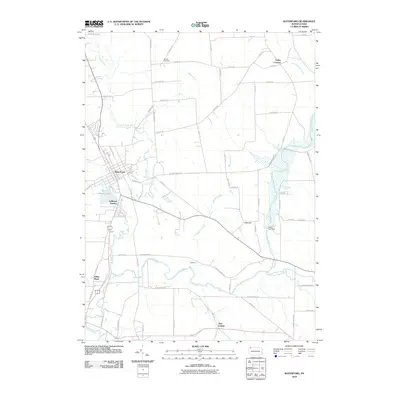
2010 Map of Waterford
USGS Topo · Published 2010About this map
French Creek and its complex tributaries, including the South Branch French Creek and LeBoeuf Creek, define the topography of this corner of Erie County. The borough of Waterford serves as the central hub, situated near the shores of LeBoeuf Lake and Trout Run. The map reveals a landscape managed by water infrastructure, notably the Union City Dam, and a rural road network that connects smaller settlements such as LeBoeuf Garden and Valley Corners. Genealogy researchers may find particular interest in Bonnell Cemetery located along W Greene Rd or the family-named landmarks like Oak Hill. The presence of New Ireland and Indian Head reflects the localized naming conventions of this agricultural and riparian region during the early twenty-first century.
Find a feature on this map
63 named features on this map. Tap any name to fly to it.
Don’t see what you’re looking for? This feature index may not catch every label — zoom into the map to look around manually.
Map Details
Editions of this 2010 Waterford Map
This is the sole edition of this map. No revisions or reprints were ever made.
Other maps of this area

1899 · Erie
USGS Topo · 1:62,500

1900 · Erie
USGS Topo · 1:62,500

1913 · North East
USGS Topo · 1:62,500

1915 · North East
USGS Topo · 1:62,500

1923 · Cambridge Springs
USGS Topo · 1:62,500

1925 · Cambridge Springs
USGS Topo · 1:62,500

1929 · Union City
USGS Topo · 1:62,500

1932 · Union City
USGS Topo · 1:62,500

1943 · North East
USGS Topo · 1:62,500

1943 · Cambridge Springs
USGS Topo · 1:62,500