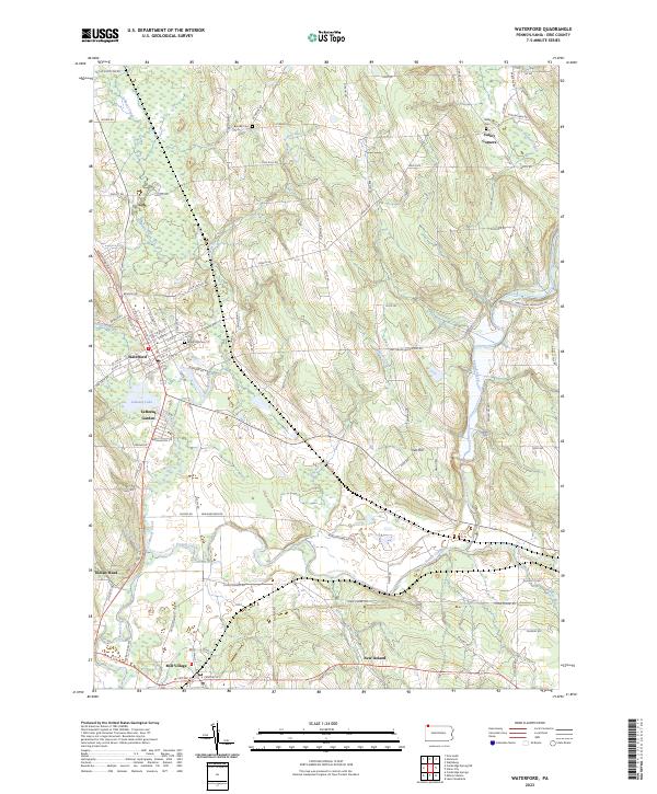
2023 Map of Waterford
USGS Topo · Published 2023About this map
Waterford serves as the primary settlement on this landscape, its grid of streets such as High St and Chestnut St organized north of the Norfolk Southern rail line. The surrounding Erie County countryside is defined by the winding course of LeBoeuf Creek and the broader waters of LeBoeuf Lake, where LeBoeuf Garden and Indian Head sit along the shoreline. Further south, Mill Village and the small hamlet of New Ireland anchor a rural landscape of ridges and valleys including Oak Hill.
Find a feature on this map
97 named features on this map. Tap any name to fly to it.
Don’t see what you’re looking for? This feature index may not catch every label — zoom into the map to look around manually.
Map Details
Editions of this 2023 Waterford Map
This is the sole edition of this map. No revisions or reprints were ever made.
Other maps of this area

1899 · Erie
USGS Topo · 1:62,500

1900 · Erie
USGS Topo · 1:62,500

1913 · North East
USGS Topo · 1:62,500

1915 · North East
USGS Topo · 1:62,500

1923 · Cambridge Springs
USGS Topo · 1:62,500

1925 · Cambridge Springs
USGS Topo · 1:62,500

1929 · Union City
USGS Topo · 1:62,500

1932 · Union City
USGS Topo · 1:62,500

1943 · North East
USGS Topo · 1:62,500

1943 · Cambridge Springs
USGS Topo · 1:62,500