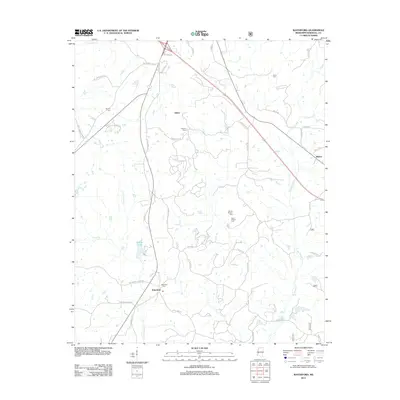
2012 Map of Waterford
USGS Topo · Published 2012About this map
Waterford serves as a central hub in this section of Marshall County, situated along the corridor of Old Highway 7 S. The landscape is defined by the headwaters of numerous creeks, including Little Spring Creek, Sand Creek, and the winding Big Spring Creek, which shape the rural settlement patterns. Several family and community burial grounds, such as Pegues Cemetery and Finley Cemetery, are scattered throughout the region, offering significant points of interest for genealogical research.
Find a feature on this map
45 named features on this map. Tap any name to fly to it.
Don’t see what you’re looking for? This feature index may not catch every label — zoom into the map to look around manually.
Map Details
Editions of this 2012 Waterford Map
This is the sole edition of this map. No revisions or reprints were ever made.
Other maps of this area

1944 · Tyro
USGS Topo · 1:62,500

1944 · Potts Camp
USGS Topo · 1:62,500

1945 · Potts Camp
USGS Topo · 1:62,500

1948 · Byhalia
USGS Topo · 1:62,500

1953 · Holly Springs
USGS Topo · 1:62,500

1956 · Tupelo
USGS Topo · 1:250,000

1958 · Tupelo
USGS Topo · 1:250,000

1964 · Waterford
USGS Topo · 1:24,000

1964 · Holly Springs SE
USGS Topo · 1:24,000
1965 · Holly Springs
USGS Topo · 1:24,000