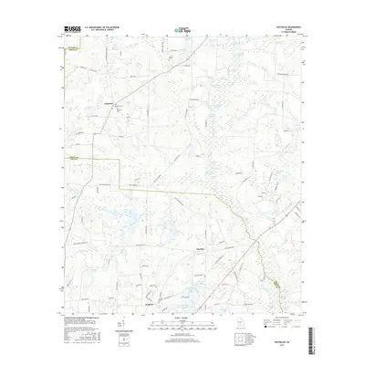
2017 Map of Waterloo
USGS Topo · Published 2017About this map
The Alapaha River corridor and its surrounding wetlands define the rural landscape of Irwin and Tift Counties in southern Georgia. This 2017 survey details the dispersed communities of Waterloo, Harding, and Brighton, highlighting the historical significance of family and community burial sites like Waterloo Cem, Eureka Cem, and Macedonia Cem. The area is characterized by a dense network of water bodies, including Tifton Fishing Club Lake, Adcock-Morris Lake, and Shikel Lake, which speak to the region's importance for local recreation and environmental drainage. Local movement is tied to a grid of county roads and highways such as the Waterloo Rebecca Hwy and Chula Brookfield Rd, connecting these small agricultural outposts through a terrain of creeks like Sand Creek and Hat Cr.
Find a feature on this map
121 named features on this map. Tap any name to fly to it.
Don’t see what you’re looking for? This feature index may not catch every label — zoom into the map to look around manually.
Map Details
Editions of this 2017 Waterloo Map
This is the sole edition of this map. No revisions or reprints were ever made.
Other maps of this area

1953 · Waycross
USGS Topo · 1:250,000

1958 · Waycross
USGS Topo · 1:250,000

1973 · Ocilla West
USGS Topo · 1:24,000

1973 · Waterloo
USGS Topo · 1:24,000

1973 · Irwinville
USGS Topo · 1:24,000

1973 · Enigma
USGS Topo · 1:24,000

1973 · Chula
USGS Topo · 1:24,000

1973 · Tifton East
USGS Topo · 1:24,000

1973 · Tifton West
USGS Topo · 1:24,000

1973 · Bethel
USGS Topo · 1:24,000