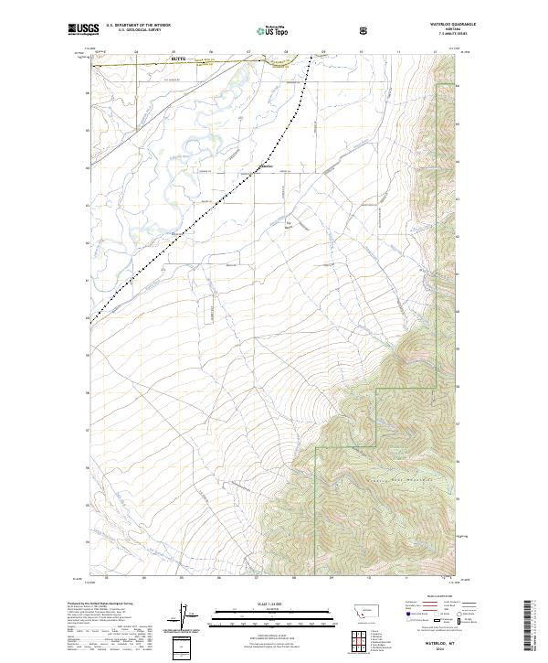
2024 Map of Waterloo
USGS Topo · Published 2024About this map
The settlement of Waterloo serves as a central landmark in this southwestern Montana landscape, positioned where the valley floor meets the rising slopes of the Tobacco Root Mountains. The geography is defined by a sophisticated irrigation network, with the Jefferson River feeding a system of man-made waterways such as Parrot Ditch, Duffy Ditch, and Creeklyn Ditch. These diversions support agriculture across The Bench, a prominent flatland that transitions into the more varied terrain of Mill Canyon and Hellroaring Canyon.
Find a feature on this map
48 named features on this map. Tap any name to fly to it.
Don’t see what you’re looking for? This feature index may not catch every label — zoom into the map to look around manually.
Map Details
Editions of this 2024 Waterloo Map
This is the sole edition of this map. No revisions or reprints were ever made.
Other maps of this area

1893 · Dillon
USGS Topo · 1:250,000

1955 · Dillon
USGS Topo · 1:250,000

1957 · Dillon
USGS Topo · 1:250,000

1958 · Dillon
USGS Topo · 1:250,000

1960 · Twin Bridges
USGS Topo · 1:62,500

1960 · Waterloo
USGS Topo · 1:62,500

1962 · Dillon
USGS Topo · 1:250,000
1963 · Whitehall
USGS Topo · 1:24,000

1963 · Vendome
USGS Topo · 1:24,000
1963 · Grace
USGS Topo · 1:24,000