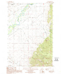
1989 Map of Waterloo
USGS Topo · Published 1989About this map
The Jefferson River meanders across this landscape in the late 1980s, creating a complex network of sloughs and irrigation channels that support local agriculture near Waterloo. This area is defined by the sharp transition from the flat agricultural plains of The Bench to the rising elevations of the Deerlodge National Forest. Significant water management is evident through the presence of the Parrot Ditch and Parsons Ditch, which redirect flow across the valley floor. To the east, the terrain becomes increasingly steep and resource-driven. Genealogists and local historians can trace legacy landholdings like the Silver Bow Ranch and White Rock Ranch, while the upland gulches reveal the region's mining heritage. Features such as the Strawn Mine and the Ohio Lode Mine located near Hellroaring Canyon point to the persistent search for minerals in the Madison County mountains.
Find a feature on this map
28 named features on this map. Tap any name to fly to it.
Don’t see what you’re looking for? This feature index may not catch every label — zoom into the map to look around manually.
Map Details
Editions of this 1989 Waterloo Map
This is the sole edition of this map. No revisions or reprints were ever made.
Other maps of this area

1893 · Dillon
USGS Topo · 1:250,000

1955 · Dillon
USGS Topo · 1:250,000

1957 · Dillon
USGS Topo · 1:250,000

1958 · Dillon
USGS Topo · 1:250,000

1960 · Twin Bridges
USGS Topo · 1:62,500

1960 · Waterloo
USGS Topo · 1:62,500

1962 · Dillon
USGS Topo · 1:250,000
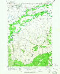
1963 · Whitehall
USGS Topo · 1:24,000

1963 · Vendome
USGS Topo · 1:24,000
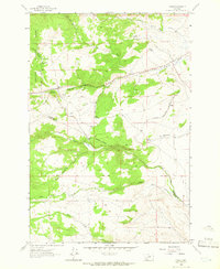
1963 · Grace
USGS Topo · 1:24,000