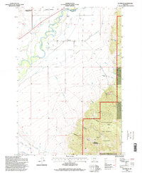
1996 Map of Waterloo
USGS Topo · Published 1998About this map
Waterloo sits at the base of The Bench, where the Jefferson River winds through a landscape defined by ranching and irrigation in the late twentieth century. This survey illustrates the intricate water management required in Madison County, with man-made features like Parrot Ditch and Cornforth Ditch diverting flow alongside natural channels such as Parsons Slough. The terrain transitions sharply from the level river valley to the steep, forested slopes of the Deerlodge National Forest. In the higher elevations to the southeast, the history of extraction is evident at the Strawn Mine and various prospects near Mill Canyon and Bumby Gulch. The map also captures several family-named agricultural operations, including Silver Bow Ranch and White Rock Ranch, documenting the enduring rural character of this Montana valley.
Find a feature on this map
32 named features on this map. Tap any name to fly to it.
Don’t see what you’re looking for? This feature index may not catch every label — zoom into the map to look around manually.
Map Details
Editions of this 1996 Waterloo Map
This is the sole edition of this map. No revisions or reprints were ever made.
Other maps of this area

1893 · Dillon
USGS Topo · 1:250,000

1955 · Dillon
USGS Topo · 1:250,000

1957 · Dillon
USGS Topo · 1:250,000

1958 · Dillon
USGS Topo · 1:250,000

1960 · Twin Bridges
USGS Topo · 1:62,500

1960 · Waterloo
USGS Topo · 1:62,500

1962 · Dillon
USGS Topo · 1:250,000
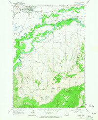
1963 · Whitehall
USGS Topo · 1:24,000

1963 · Vendome
USGS Topo · 1:24,000
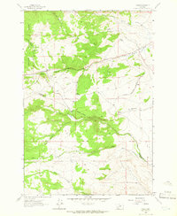
1963 · Grace
USGS Topo · 1:24,000