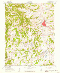
1954 Map of Waterloo
USGS Topo · Published 1959About this map
Waterloo serves as the central hub of this Monroe County landscape, showing its mid-century urban core surrounded by a network of smaller agricultural settlements. The rural areas are defined by several small communities, including Wartburg, Burksville, and Madonnaville, each typically centered around a local church or school. Education and faith were clearly foundational to the area's development, evidenced by numerous rural institutions like Old Rock Sch, Fountain Creek Sch, and Salem Ch.
Find a feature on this map
31 named features on this map. Tap any name to fly to it.
Don’t see what you’re looking for? This feature index may not catch every label — zoom into the map to look around manually.
Map Details
Editions of this 1954 Waterloo Map
4 editions found
Other maps of this area

1910 · Waterloo
USGS Topo · 1:62,500

1912 · Kimmswick
USGS Topo · 1:62,500

1913 · Waterloo
USGS Topo · 1:62,500

1915 · Renault
USGS Topo · 1:62,500

1915 · Crystal City
USGS Topo · 1:62,500

1916 · Kimmswick
USGS Topo · 1:62,500

1940 · Renault
USGS Topo · 1:62,500

1948 · Kimmswick
USGS Topo · 1:62,500

1949 · Saint Louis
USGS Topo · 1:250,000

1949 · Crystal City
USGS Topo · 1:62,500