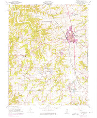
1954 Map of Waterloo
USGS Topo · Published 1975About this map
Waterloo serves as the focal point of this mid-century survey, shown as it expanded along the Illinois Central Gulf railroad line. The surrounding landscape in Monroe County is characterized by a network of rural settlements and agricultural hubs, including Wartburg, Burksville, and Madonnaville. For genealogists and local historians, the map is remarkably dense with specific cultural landmarks, from the Holy Cross School and Old Rock School to several congregational centers like St Johns Ch and Salem Ch. The drainage patterns of Fountain Creek and Bond Creek dictate much of the rural layout, with recreational and natural features such as Island Lake and Camp Vandeventer scattered throughout the territory. Notable burial sites, including SS Peter and Paul Cem and Kolmer Cem, are clearly marked, providing essential data points for tracing early family lineages in the region.
Find a feature on this map
26 named features on this map. Tap any name to fly to it.
Don’t see what you’re looking for? This feature index may not catch every label — zoom into the map to look around manually.
Map Details
Editions of this 1954 Waterloo Map
4 editions found
Other maps of this area

1910 · Waterloo
USGS Topo · 1:62,500

1912 · Kimmswick
USGS Topo · 1:62,500

1913 · Waterloo
USGS Topo · 1:62,500

1915 · Renault
USGS Topo · 1:62,500

1915 · Crystal City
USGS Topo · 1:62,500

1916 · Kimmswick
USGS Topo · 1:62,500

1940 · Renault
USGS Topo · 1:62,500

1948 · Kimmswick
USGS Topo · 1:62,500

1949 · Saint Louis
USGS Topo · 1:250,000

1949 · Crystal City
USGS Topo · 1:62,500