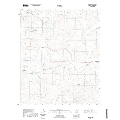
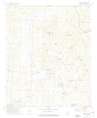
2020 Map of Waterloo
USGS Topo · Published 2020About this map
Waterloo and several surrounding small rural settlements define this portion of Nevada County, where a dense network of country roads connects family burial grounds and community landmarks. The landscape is deeply dissected by numerous creeks and branches, including Williams Cr, Black Cr, and Brushy Cr, which dictate the winding paths of local routes like State Hwy 76. Local history is anchored by a high concentration of cemeteries such as Harrison Chapel Cem, New Salem Church Cem, and Rocky Mound Cem, reflecting the generations of families who established farms near crossroads like Oak Grove and Ames. These features, along with names like Mendenhall and Young, provide essential geographic markers for researchers tracing the rural development and ancestral homesteads of southwest Arkansas.
Find a feature on this map
62 named features on this map. Tap any name to fly to it.
Don’t see what you’re looking for? This feature index may not catch every label — zoom into the map to look around manually.
Map Details
Editions of this 2020 Waterloo Map
This is the sole edition of this map. No revisions or reprints were ever made.
Other maps of this area

1901 · Gurdon
USGS Topo · 1:125,000

1953 · El Dorado
USGS Topo · 1:250,000

1957 · El Dorado
USGS Topo · 1:250,000

1958 · El Dorado
USGS Topo · 1:250,000

1960 · El Dorado
USGS Topo · 1:250,000

1968 · Lamartine
USGS Topo · 1:24,000
1969 · Stephens
USGS Topo · 1:24,000
1969 · Magnolia NW
USGS Topo · 1:24,000
1973 · Chidester
USGS Topo · 1:24,000
1973 · Bluff City
USGS Topo · 1:24,000