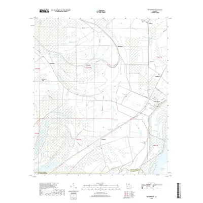
2018 Map of Waterproof
USGS Topo · Published 2018About this map
Waterproof anchor this Mississippi River floodplain landscape, where a dense network of bayous and lakes defines the local geography. The map reveals the intricate drainage patterns of the Little Tensas River and the Buffalo Bayou, reflecting a terrain deeply tied to the alluvial environment of Tensas Parish. Small settlements and naming conventions like Highland, Richland, and Independent Ridge suggest a history of agricultural development on the higher ground between seasonal wetlands. Local history and genealogy are anchored by specific landmarks such as Helena Cem near the northern boundary and Winona Cem further south. The presence of the Waterproof Cutoff and Gorton Chute illustrates the dynamic nature of the nearby river system, while the grid of parish roads and named lanes like Myrtle Grove Ln connects the scattered communities of Azucena and Goldman.
Find a feature on this map
65 named features on this map. Tap any name to fly to it.
Don’t see what you’re looking for? This feature index may not catch every label — zoom into the map to look around manually.
Map Details
Editions of this 2018 Waterproof Map
This is the sole edition of this map. No revisions or reprints were ever made.
Other maps of this area

1909 · Delta Bridge
USGS Topo · 1:24,000

1921 · Natchez
USGS Topo · 1:48,000

1922 · Natchez
USGS Topo · 1:62,500

1939 · Red Gum
USGS Topo · 1:62,500

1939 · Natchez
USGS Topo · 1:62,500

1939 · Locust Ridge
USGS Topo · 1:62,500

1941 · Sicily Island
USGS Topo · 1:62,500

1953 · Natchez
USGS Topo · 1:250,000

1956 · Natchez
USGS Topo · 1:250,000

1957 · Sicily Island
USGS Topo · 1:62,500