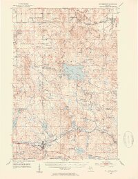
1952 Map of Watersmeet
USGS Topo · Published 1954About this map
The Middle Branch Ontonagon River dominates this mid-century survey of the Upper Peninsula, showing a landscape defined by its timber heritage and the hydraulic infrastructure of the Bond Falls Flowage. At the intersection of major transportation routes, Watersmeet serves as a vital hub for the Chicago and North Western and Milwaukee Road railroads. The map records several small settlements and sidings such as Paulding, Craigsmere, and Calderwood, many of which were centers for the region's logging industry. Genealogists will find critical local landmarks including Maple Grove Cem near the river and Agate Cem north of Agate Hill. The presence of a Landing Field and multiple radio and lookout towers reflects the post-war modernization of forest management and communications in this wooded corridor between Ontonagon and Gogebic counties.
Find a feature on this map
99 named features on this map. Tap any name to fly to it.
Don’t see what you’re looking for? This feature index may not catch every label — zoom into the map to look around manually.
Map Details
Editions of this 1952 Watersmeet Map
5 editions found
Other maps of this area

1938 · Phelps
USGS Topo · 1:48,000

1946 · Star Lake
USGS Topo · 1:48,000

1949 · Rockland
USGS Topo · 1:62,500

1950 · Phelps
USGS Topo · 1:48,000

1950 · Star Lake
USGS Topo · 1:48,000

1951 · Rockland
USGS Topo · 1:62,500

1952 · Watersmeet
USGS Topo · 1:62,500

1952 · Thayer
USGS Topo · 1:62,500

1954 · Rousseau
USGS Topo · 1:62,500

1954 · Kenton
USGS Topo · 1:62,500