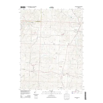
2013 Map of Watertown
USGS Topo · Published 2013About this map
Wolf Creek and its numerous branching tributaries, including the South Branch Wolf Creek and Southwest Fork S Br Wolf Cr, define the drainage patterns of this Washington County landscape. The settlement of Watertown sits at the junction of several county roads, while Barlow and Vincent anchor the southeastern portion of the map. This 2013 survey illustrates the modern road network, including Oh-339, Oh-676, and Oh-550, which connect these small rural communities. Genealogists will find several burial grounds across the townships, such as Barlow Central Cem, Layman Cem, and N Watertown Cem. Local infrastructure is marked by crossings like Harra Bridge and Bell Bridge, which span the creek system that once drove the early development of this region. The map also captures the Little Hocking River flowing near the southern boundary, highlighting the intricate hydrology of the area.
Find a feature on this map
122 named features on this map. Tap any name to fly to it.
Don’t see what you’re looking for? This feature index may not catch every label — zoom into the map to look around manually.
Map Details
Editions of this 2013 Watertown Map
This is the sole edition of this map. No revisions or reprints were ever made.
Other maps of this area

1902 · Parkersburg
USGS Topo · 1:62,500

1904 · Parkersburg
USGS Topo · 1:62,500

1904 · Chesterhill
USGS Topo · 1:62,500

1906 · Chesterhill
USGS Topo · 1:62,500

1909 · Caldwell
USGS Topo · 1:62,500

1910 · Mc Connelsville
USGS Topo · 1:62,500

1912 · Caldwell
USGS Topo · 1:62,500

1949 · Clarksburg
USGS Topo · 1:250,000

1956 · Clarksburg
USGS Topo · 1:250,000
1957 · Parkersburg
USGS Topo · 1:24,000