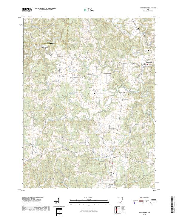
2023 Map of Watertown
USGS Topo · Published 2023About this map
Wolf Creek and Watertown anchor this rural landscape in Washington County, where the dendritic drainage patterns of the West Branch Wolf Creek and South Branch Wolf Creek carve through the terrain. The map documents a dense network of township roads and local cemeteries that speak to generations of settlement, including Stanley Cem, North Watertown Cem, and Layman Cem near the community of Layman. An interesting modern aviation feature, Rod's Sod Airport, is situated south of Barlow. The area's hydrology is complex, with various tributaries like Tupper Creek and the Little Hocking River feeding into larger systems, illustrating the topographical challenges faced by early builders of Co Rd 18 and Twp Rd 177.
Find a feature on this map
72 named features on this map. Tap any name to fly to it.
Don’t see what you’re looking for? This feature index may not catch every label — zoom into the map to look around manually.
Map Details
Editions of this 2023 Watertown Map
This is the sole edition of this map. No revisions or reprints were ever made.
Other maps of this area

1902 · Parkersburg
USGS Topo · 1:62,500

1904 · Parkersburg
USGS Topo · 1:62,500

1904 · Chesterhill
USGS Topo · 1:62,500

1906 · Chesterhill
USGS Topo · 1:62,500

1909 · Caldwell
USGS Topo · 1:62,500

1910 · Mc Connelsville
USGS Topo · 1:62,500

1912 · Caldwell
USGS Topo · 1:62,500

1949 · Clarksburg
USGS Topo · 1:250,000

1956 · Clarksburg
USGS Topo · 1:250,000
1957 · Parkersburg
USGS Topo · 1:24,000