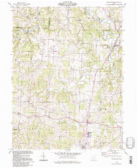
1994 Map of Watertown
USGS Topo · Published 1998About this map
The rolling hills of western Washington County are defined by the winding course of Wolf Creek and its many tributaries, including the West Branch and South Fork. In the late twentieth century, this landscape remained primarily rural, anchored by the long-standing settlements of Watertown, Barlow, and Vincent. The map reveals a dense network of energy infrastructure, with numerous Oil Wells and Gas Wells scattered across the township boundaries of Palmer and Barlow, indicating the region's continued reliance on local extraction. Educational and social centers like the Warren High School and Camp Hervida serve as important community landmarks.
Find a feature on this map
40 named features on this map. Tap any name to fly to it.
Don’t see what you’re looking for? This feature index may not catch every label — zoom into the map to look around manually.
Map Details
Editions of this 1994 Watertown Map
This is the sole edition of this map. No revisions or reprints were ever made.
Other maps of this area

1902 · Parkersburg
USGS Topo · 1:62,500

1904 · Parkersburg
USGS Topo · 1:62,500

1904 · Chesterhill
USGS Topo · 1:62,500

1906 · Chesterhill
USGS Topo · 1:62,500

1909 · Caldwell
USGS Topo · 1:62,500

1910 · Mc Connelsville
USGS Topo · 1:62,500

1912 · Caldwell
USGS Topo · 1:62,500

1949 · Clarksburg
USGS Topo · 1:250,000

1956 · Clarksburg
USGS Topo · 1:250,000
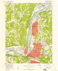
1957 · Parkersburg
USGS Topo · 1:24,000