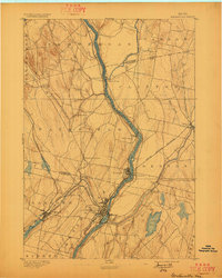
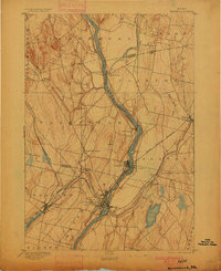
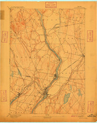
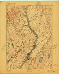
1892 Map of Waterville
USGS Topo · Published 1897About this map
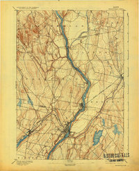
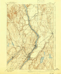
The Kennebec River serves as the central artery for this late 19th-century landscape, driving the industrial development of Waterville and its surrounding mill towns. This 1890 survey illustrates a complex transport network where water and rail intersect, featuring the Maine Central Railroad and the Somerset Railroad converging near the riverbanks. The importance of river crossings is evident at Pishon Ferry and Benton Falls, while smaller agricultural and industrial outposts like Shawmut and Larone are already well-established.
Find a feature on this map
33 named features on this map. Tap any name to fly to it.
Don’t see what you’re looking for? This feature index may not catch every label — zoom into the map to look around manually.
Map Details
Editions of this 1892 Waterville Map
7 editions found
Other maps of this area

1892 · Waterville
USGS Topo · 1:62,500

1892 · Augusta
USGS Topo · 1:62,500

1893 · Vassalboro
USGS Topo · 1:62,500

1894 · Norridgewock
USGS Topo · 1:62,500

1898 · Norridgewock
USGS Topo · 1:62,500

1898 · Vassalboro
USGS Topo · 1:62,500

1904 · Anson
USGS Topo · 1:62,500

1913 · Skowhegan
USGS Topo · 1:62,500

1916 · Liberty
USGS Topo · 1:62,500

1926 · Burnham
USGS Topo · 1:62,500