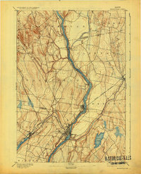
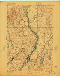
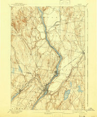
1892 Map of Waterville
USGS Topo · Published 1930About this map
The Waterville industrial and transportation hub serves as the anchor of this late nineteenth-century landscape, where the confluence of the Kennebec River and Sebasticook River dictated early settlement patterns. W.H. Lovell's topography reveals a complex network of river-driven commerce, from the ferry crossing at Pishon Ferry to the manufacturing nodes of Shawmut and Benton Falls. The dominance of the Maine Central Railroad is evident as it snakes through Winslow and Benton, while the Somerset Railroad connects westward through Oakland toward Messalonskee Lake. This survey captures a moment before modern consolidation, preserving the distinct identities of smaller hamlets like Fairfield Center, Larone, and North Fairfield that defined the rural character of the Somerset and Kennebec County line.
Find a feature on this map
33 named features on this map. Tap any name to fly to it.
Don’t see what you’re looking for? This feature index may not catch every label — zoom into the map to look around manually.
Map Details
Editions of this 1892 Waterville Map
7 editions found
Other maps of this area

1892 · Waterville
USGS Topo · 1:62,500

1892 · Augusta
USGS Topo · 1:62,500

1893 · Vassalboro
USGS Topo · 1:62,500

1894 · Norridgewock
USGS Topo · 1:62,500

1898 · Norridgewock
USGS Topo · 1:62,500

1898 · Vassalboro
USGS Topo · 1:62,500

1904 · Anson
USGS Topo · 1:62,500

1913 · Skowhegan
USGS Topo · 1:62,500

1916 · Liberty
USGS Topo · 1:62,500

1926 · Burnham
USGS Topo · 1:62,500