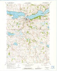
1966 Map of Waterville
USGS Topo · Published 1988About this map
The town of Waterville sits at the narrow junction between Tetonka Lake and Sakatah Lake, a landscape defined by the drainage of the Cannon River. In the mid-1960s, this area of southern Minnesota reflects a transition from early pioneer settlement to recreation and conservation, shown by the establishment of Sakatah State Park and the Fish Hatchery on the shores of Antl Bay. The transportation network is anchored by the Chicago and North Western railroad, which skirts the northern edges of the lakes and cuts through the heart of the town.
Find a feature on this map
44 named features on this map. Tap any name to fly to it.
Don’t see what you’re looking for? This feature index may not catch every label — zoom into the map to look around manually.
Map Details
Editions of this 1966 Waterville Map
2 editions found
Other maps of this area

1953 · Saint Paul
USGS Topo · 1:250,000

1959 · Saint Paul
USGS Topo · 1:250,000

1960 · Shieldsville
USGS Topo · 1:24,000

1962 · Morristown
USGS Topo · 1:24,000

1962 · Meriden
USGS Topo · 1:24,000

1966 · Waseca
USGS Topo · 1:24,000

1966 · Janesville
USGS Topo · 1:24,000

1966 · Waterville
USGS Topo · 1:24,000

1966 · Cordova
USGS Topo · 1:24,000

1966 · Elysian
USGS Topo · 1:24,000