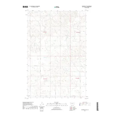
2017 Map of Watford City NE
USGS Topo · Published 2017About this map
Wild Cow Cr meanders through the dissected Badlands landscape of McKenzie County, carving a network of drainages across this portion of North Dakota. In 2017, the area remained defined by its sparse, rural character and a strictly gridded system of section lines and gravel access roads. A network of county and local roads, including Co RD 35, 35th Ave NW, and 127th Ave NW, provides access across the high plateaus and coulees. The landscape is segmented by township boundaries, notably t152n r99w and t152n r98w, which organize the territory for both agricultural use and potential energy development. This 1:24,000 scale survey illustrates the fine-grained topographic detail of the breaks and buttes that characterize this region of the Missouri Plateau.
Find a feature on this map
14 named features on this map. Tap any name to fly to it.
Don’t see what you’re looking for? This feature index may not catch every label — zoom into the map to look around manually.
Map Details
Editions of this 2017 Watford City NE Map
This is the sole edition of this map. No revisions or reprints were ever made.
Other maps of this area

1911 · Ray
USGS Topo · 1:125,000

1953 · Williston
USGS Topo · 1:250,000

1953 · Watford City
USGS Topo · 1:250,000

1957 · Williston
USGS Topo · 1:250,000

1957 · Watford City
USGS Topo · 1:250,000

1967 · Watford City
USGS Topo · 1:250,000

1978 · Lake Jessie
USGS Topo · 1:24,000

1978 · Watford City NW
USGS Topo · 1:24,000

1978 · Arnegard
USGS Topo · 1:24,000

1978 · Schafer
USGS Topo · 1:24,000