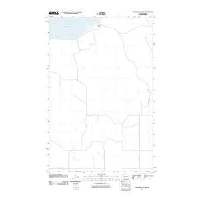
2011 Map of Watford City NW
USGS Topo · Published 2011About this map
Audubon Lake and the northern reaches of Tobacco Garden Creek define this rural McKenzie County landscape. The area is characterized by wide-open prairie topography and a grid-based transportation network, including County Rd 18 and County Rd 29. One of the few specific landmarks identified is the Kellogg Ranch, situated near the shoreline of the lake. This survey documents the region as it appeared in the early 21st century, illustrating the intersection of natural water bodies and the established road systems such as A Route 18 and County Rd 31. The layout reflects the enduring ranching and agricultural character of western North Dakota, where the placement of individual holdings like the Kellogg Ranch remains a central point of reference in an expansive landscape.
Find a feature on this map
7 named features on this map. Tap any name to fly to it.
Don’t see what you’re looking for? This feature index may not catch every label — zoom into the map to look around manually.
Map Details
Editions of this 2011 Watford City NW Map
This is the sole edition of this map. No revisions or reprints were ever made.
Other maps of this area

1911 · Ray
USGS Topo · 1:125,000

1953 · Williston
USGS Topo · 1:250,000

1953 · Watford City
USGS Topo · 1:250,000

1957 · Williston
USGS Topo · 1:250,000

1957 · Watford City
USGS Topo · 1:250,000

1967 · Watford City
USGS Topo · 1:250,000

1972 · Rawson
USGS Topo · 1:24,000

1978 · Lake Jessie
USGS Topo · 1:24,000

1978 · Watford City NW
USGS Topo · 1:24,000

1978 · Arnegard
USGS Topo · 1:24,000