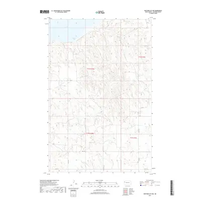
2017 Map of Watford City NW
USGS Topo · Published 2017About this map
Lake Sakakawea dominates the northern reaches of this McKenzie County landscape, where the waters of Wild Cow Bay meet the dissected uplands of the Missouri Plateau. This 2017 survey illustrates the complex drainage patterns of the region, specifically where Tobacco Garden Cr winds through the southern townships before heading toward the Missouri River system. The interior is defined by a sparse but structured network of section-line roads, including Co Rd 29 and Co Rd 31, which provide access to the high, rolling ranchlands and prairie between the lake and the more developed corridors to the south. The absence of concentrated settlements highlights the rural character of this portion of North Dakota, focusing instead on the topographic variations and water features that dictate land use in the badlands-fringe environment.
Find a feature on this map
15 named features on this map. Tap any name to fly to it.
Don’t see what you’re looking for? This feature index may not catch every label — zoom into the map to look around manually.
Map Details
Editions of this 2017 Watford City NW Map
This is the sole edition of this map. No revisions or reprints were ever made.
Other maps of this area

1911 · Ray
USGS Topo · 1:125,000

1953 · Williston
USGS Topo · 1:250,000

1953 · Watford City
USGS Topo · 1:250,000

1957 · Williston
USGS Topo · 1:250,000

1957 · Watford City
USGS Topo · 1:250,000

1967 · Watford City
USGS Topo · 1:250,000

1972 · Rawson
USGS Topo · 1:24,000

1978 · Lake Jessie
USGS Topo · 1:24,000

1978 · Watford City NW
USGS Topo · 1:24,000

1978 · Arnegard
USGS Topo · 1:24,000