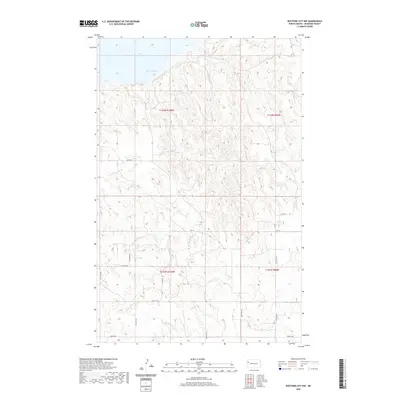
2020 Map of Watford City NW
USGS Topo · Published 2020About this map
Lake Sakakawea dominates the northern reaches of this McKenzie County landscape, where the waters of Wild Cow Bay meet a complex terrain of breaks and coulees. This 2020 topographic survey illustrates the rural infrastructure of the Missouri River plateau, defined by a rigid grid of section lines and gravel routes such as 136th Ave NW and 34th St NW. The drainage patterns are anchored by Tobacco Garden Cr, which carves through the southern sections. While the uplands are sparse of named settlements, the presence of improved roads like Co Rd 29 and A Rt 18 indicates the persistent footprint of ranching and energy-related access in the North Dakota Badlands region. Genealogists and land researchers can use the precise Public Land Survey System notations, such as t152n r100w, to pinpoint specific historic family parcels.
Find a feature on this map
18 named features on this map. Tap any name to fly to it.
Don’t see what you’re looking for? This feature index may not catch every label — zoom into the map to look around manually.
Map Details
Editions of this 2020 Watford City NW Map
This is the sole edition of this map. No revisions or reprints were ever made.
Other maps of this area

1911 · Ray
USGS Topo · 1:125,000

1953 · Williston
USGS Topo · 1:250,000

1953 · Watford City
USGS Topo · 1:250,000

1957 · Williston
USGS Topo · 1:250,000

1957 · Watford City
USGS Topo · 1:250,000

1967 · Watford City
USGS Topo · 1:250,000

1972 · Rawson
USGS Topo · 1:24,000

1978 · Lake Jessie
USGS Topo · 1:24,000

1978 · Watford City NW
USGS Topo · 1:24,000

1978 · Arnegard
USGS Topo · 1:24,000